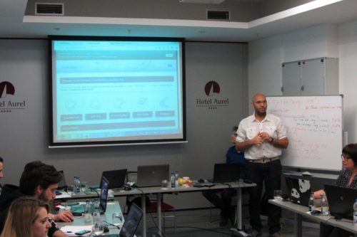
The SWOS partners, Tour du Valat and ETC-UMA, jointly organised the first training for users from West-Balkan countries. A total number of 10 users from 4 countries (Albania, Croatia, Montenegro, and Serbia) gathered in Podgorica (Montenegro) at the shore of Lake Skadar, the largest lake in the region and one of Europe’s most important wetlands.
The users included environmental agencies and wetlands managers, as representatives from the Albanian Ministry of Environment and its Agency for Nature Protection, the Regional Administration of Protected Areas Shkodër, the Public Enterprise for National Parks in Montenegro, the Nature Park of Lonjsko Polje (Croatia) and the Institute for Nature Conservation of the Vojvodina province (Serbia).
The aim of the training was to:
- Provide an overview of the SWOS services and products for wetland mapping and monitoring;
- Build capacities in the use of satellite images for Land Use Land Cover and Surface Water Dynamics mapping with SWOS’s remote sensing software GEOclassifier;
- Broaden the SWOS user network and build a SWOS community in the West-Balkan region;
- Include new test sites and service cases relevant for the users.
- Strengthen the involvement of the Mediterranean Wetlands Observatory and it technical partners like the ETC-UMA to support wetland conservation organisations in the MedWet countries;
- Collaborate with local users to gather field data for maps validation.
The two and a half day workshop started with a welcome from representatives of the Public Entreprise for National Parks in Montenegro, in charge of monitoring and management of the National Park Skadar Lake. During the practical sessions, the participants started to learn different functionalities of the GEOclassifier, to elaborate their own land use/land cover and surface water dynamic maps for two test sites: Skadar Lake (transboundary wetland between Albania and Montenegro) and Lonjsko Polje floodplain in Croatia.
In addition to the SWOS test site Skadar Lake, the inclusion of new SWOS demonstration wetlands in Croatia and Serbia were discussed. All these test sites will provide interesting service cases to support local and regional users regarding the wetland monitoring and management, through the mapping of Land Use/Land Cover and surface water dynamics (including inter-annual) changes, the assessment of ecosystem services (e.g. flood regulation) and support wetlands inventorying by provide maps of potential wetland areas.
As follow up of the training, both ETC-UMA and Tour du Valat will regularly exchange with the users for a tailor-made production and validation of SWOS products as well as continuously inform them about any news related to the SWOS service components (portal, GEOclassifier, capacity-building opportunities, mapping products).
More information
Visit the website of the SWOS project here
Visit the SWOS Facebook page here
Read our previous articles
Satellite-based Wetland Observation Service (SWOS) project kick off
Satellite-based Wetland Observation Service (SWOS) project user requirement workshop
Contact
Anis Guelmami


Share